Batangas, Philippines | Difficulty 4/9
Mount Batulao, located in Nasugbu, Batangas, remains a popular hiking destination known for its scenic landscapes and beginner-friendly trails. Just a few hours from Manila, it offers an accessible yet rewarding outdoor adventure. The mountain holds fame for its distinctive jagged peaks, which resemble a blade’s edge ('bato sa ilaw' in local terms), creating a dramatic skyline.
Hikers enjoy panoramic views of rolling hills, grasslands, and a cool breeze, making it an ideal spot for a day hike or a quick escape from the city’s hustle. Whether you count yourself a seasoned trekker or a first-time hiker, Mount Batulao promises a memorable experience amidst nature.
The Trail
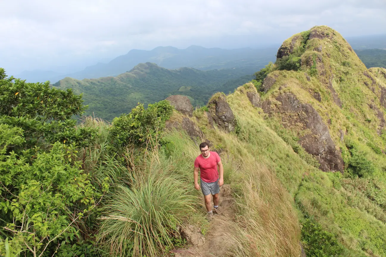
Standing at approximately 811 meters above sea level, Mt. Batulao offers breathtaking views of the surrounding landscape, including verdant valleys and distant mountain ranges. It features distinct twin peaks, known as the "Old Trail" and the "New Trail."
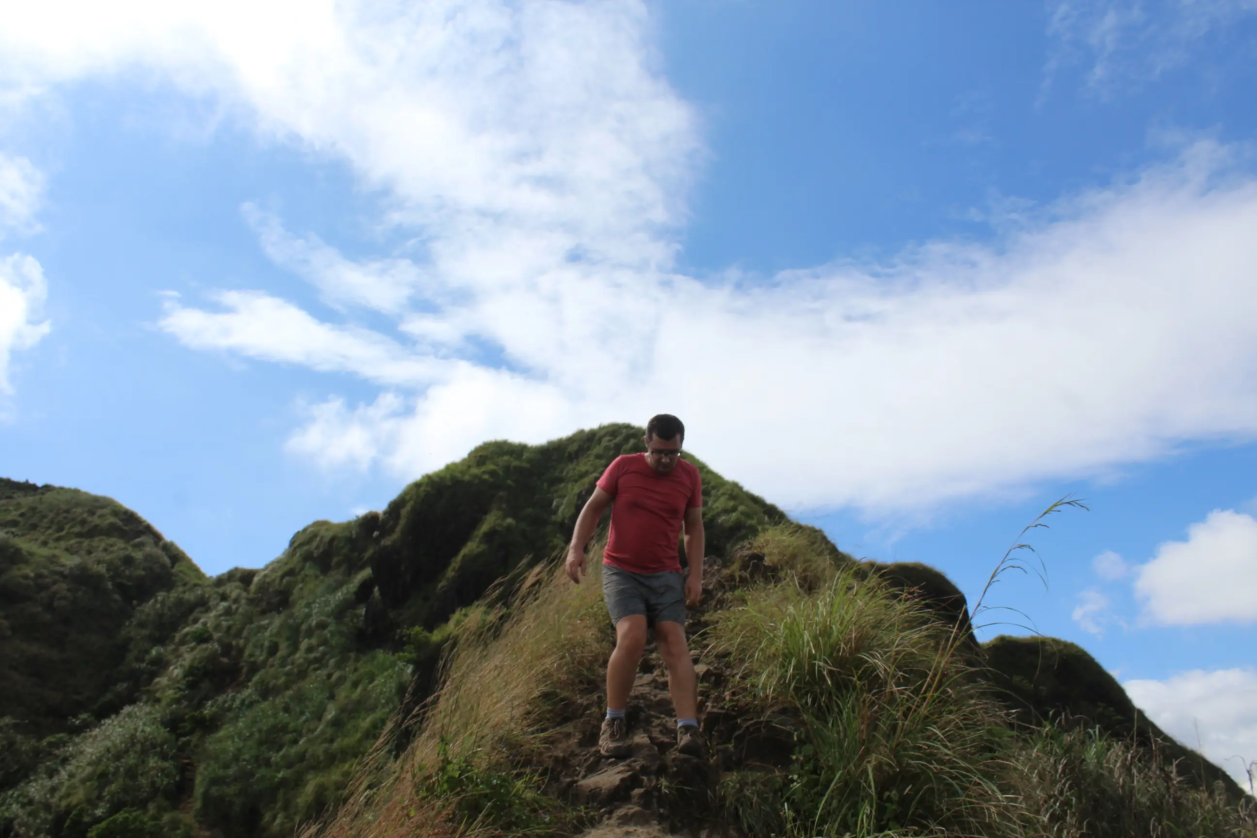
The Old Trail provides the traditional and more challenging route up Mt. Batulao. It features steep slopes, narrow ridges, and rocky terrains, giving hikers a thrilling adventure. Alternatively, the New Trail, established in recent years, offers a more gradual ascent with a wider and well-maintained path, making it a preferred option for beginners.
The Summit
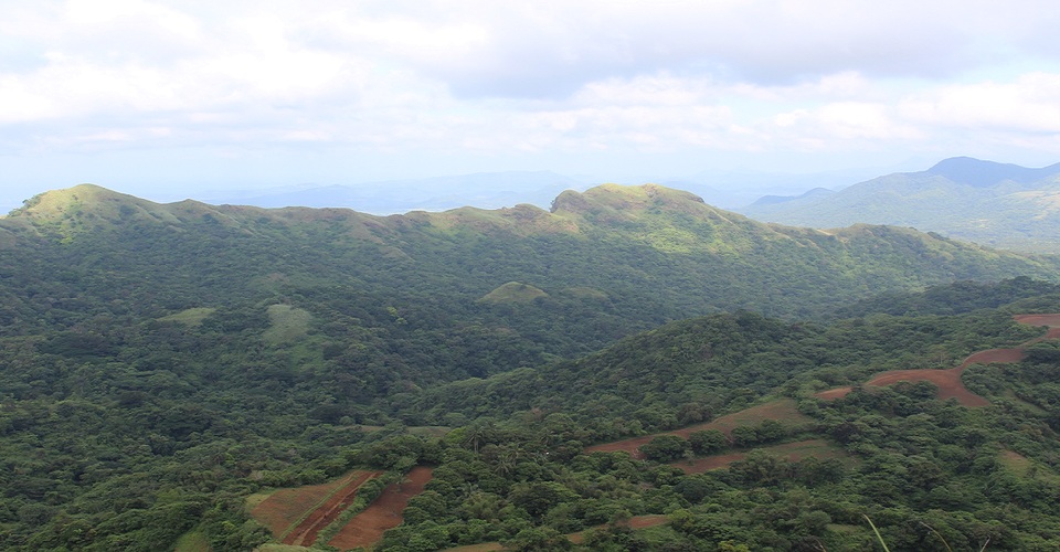
One of the highlights of hiking Mt. Batulao involves the breathtaking 360-degree panoramic view from the summit. On a clear day, hikers can spot nearby landmarks such as the Taal Volcano, Batangas Bay, and even the South China Sea. It provides a rewarding sight that attracts many nature enthusiasts and photographers.
The landscape at the top mostly consists of grassland, with dramatic peaks and valleys falling away in every direction. Standing at the peak perfectly highlights the sheer scale of the Batangas mountain ranges.
Starting Point
The hike typically begins at the Evercrest Golf Course and Resort, located in Nasugbu, Batangas. From there, hikers follow a dirt road leading to the base of the mountain. You pass by local houses and registration points before reaching the actual trailhead. Both the old and new trails start from this area, offering different routes to the summit.
If Evercrest Golf Course and Resort is closed, simply pin "Parking Mt Batulao" in Google Maps to find the correct entry point.
How to Get to Mount Batulao
Reaching the jump-off point from Manila requires only a straightforward bus ride. Head to the DLTB or BSC bus terminals in Pasay (Buendia or Taft). Board any bus bound for Nasugbu or Lian, Batangas. Tell the bus conductor to drop you off at Evercrest Golf Course in Nasugbu.
The bus journey usually takes around two to three hours depending on traffic. Once you drop off at Evercrest, tricycle drivers wait at the highway corner. Hire a tricycle to take you directly to the registration area, which saves you a long, exhausting walk on a paved road before the hike even begins.
Breakdown of Fees
Mount Batulao operates with a unique fee structure. Locals manage different parts of the mountain, meaning hikers must pay small environmental fees at multiple campsites along the trail. Bring smaller bills to make these payments easier.
- Tricycle Fare: ₱100 to ₱150 per tricycle from the highway to the jump-off.
- Registration Fees: Expect to pay around ₱140 to ₱200 in total, spread across the different trail camps.
- Tour Guide: Hiring a guide remains optional but highly recommended for first-timers, especially if doing a traverse. Guides usually charge around ₱500 to ₱1000 depending on the specific trail and group size.
Old Trail vs. New Trail
Hikers usually choose between the Old Trail and the New Trail. Many opt for a "traverse," climbing up one trail and going down the other to experience the entire mountain.
The New Trail offers a gradual, beginner-friendly ascent. The path remains mostly wide and straightforward, making it perfect for a relaxed climb toward the summit.
The Old Trail presents a steeper, more technical challenge. Hikers must navigate narrow ridges and use fixed ropes to pull themselves up or rappel down short rocky sections. Most guides recommend taking the New Trail up for an easy ascent and the Old Trail down to complete the full Batulao experience.
What to Pack & Safety Tips
Mount Batulao features open grasslands with almost zero tree cover. The sun beats down intensely on the exposed ridges, making heat exhaustion the biggest challenge for hikers.
- Hydration: Pack at least 2 to 3 liters of water per person. Local vendors sell cold drinks at the campsites, but bringing your own primary supply remains crucial.
- Sun Protection: Wear breathable long sleeves, a wide-brimmed hat, and plenty of sunscreen to prevent severe sunburns.
- Footwear: Wear proper hiking shoes. The dry season turns the trails into loose, slippery dust, requiring footwear with excellent grip.
- Gloves: Bring a pair of cheap hiking gloves to protect your hands when holding the ropes on the Old Trail.
Best Time to Visit
The best time to hike Mount Batulao falls during the dry season from November to February. During these months, the weather stays cooler, and the skies usually remain clear, providing perfect views of the mountain’s rolling hills and rugged peaks. Avoid the rainy season (June to October) as the trails quickly become muddy and slippery, significantly increasing the trek's difficulty.
Camping Options
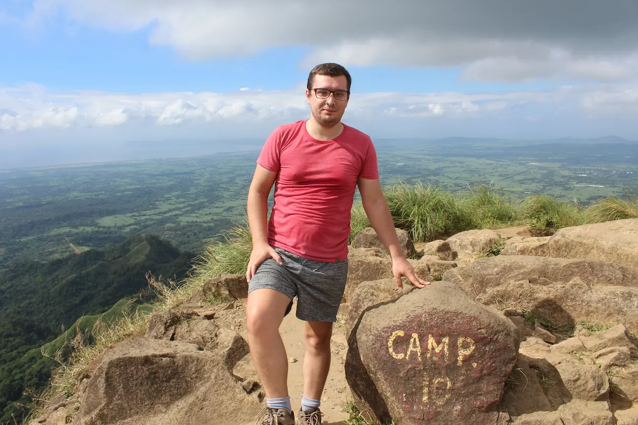
If you want to extend your adventure, Mount Batulao offers several camping spots along the trail, particularly near Peak 8 and the summit area. Many hikers opt for an overnight stay to catch the sunrise or sunset from the top. The campsite near Peak 10 proves especially popular for its wide open space and stunning views of the horizon.