In This Guide
Discovering Mount Ulap: A Must-Visit Destination
Nestled in the heart of Benguet, Philippines, Mount Ulap serves as a hiker’s paradise that offers breathtaking views, rolling hills, and an unforgettable outdoor adventure. Known for its scenic trails, pine forests, and panoramic vistas of the Cordillera mountain range, this popular hiking destination attracts nature lovers and thrill-seekers alike. Whether you consider yourself a beginner or a seasoned trekker, Mount Ulap’s well-marked paths provide a perfect blend of challenge and beauty. The stunning Gungal Rock acts as a major highlight, giving you an epic viewpoint to capture the sea of clouds on a clear day.
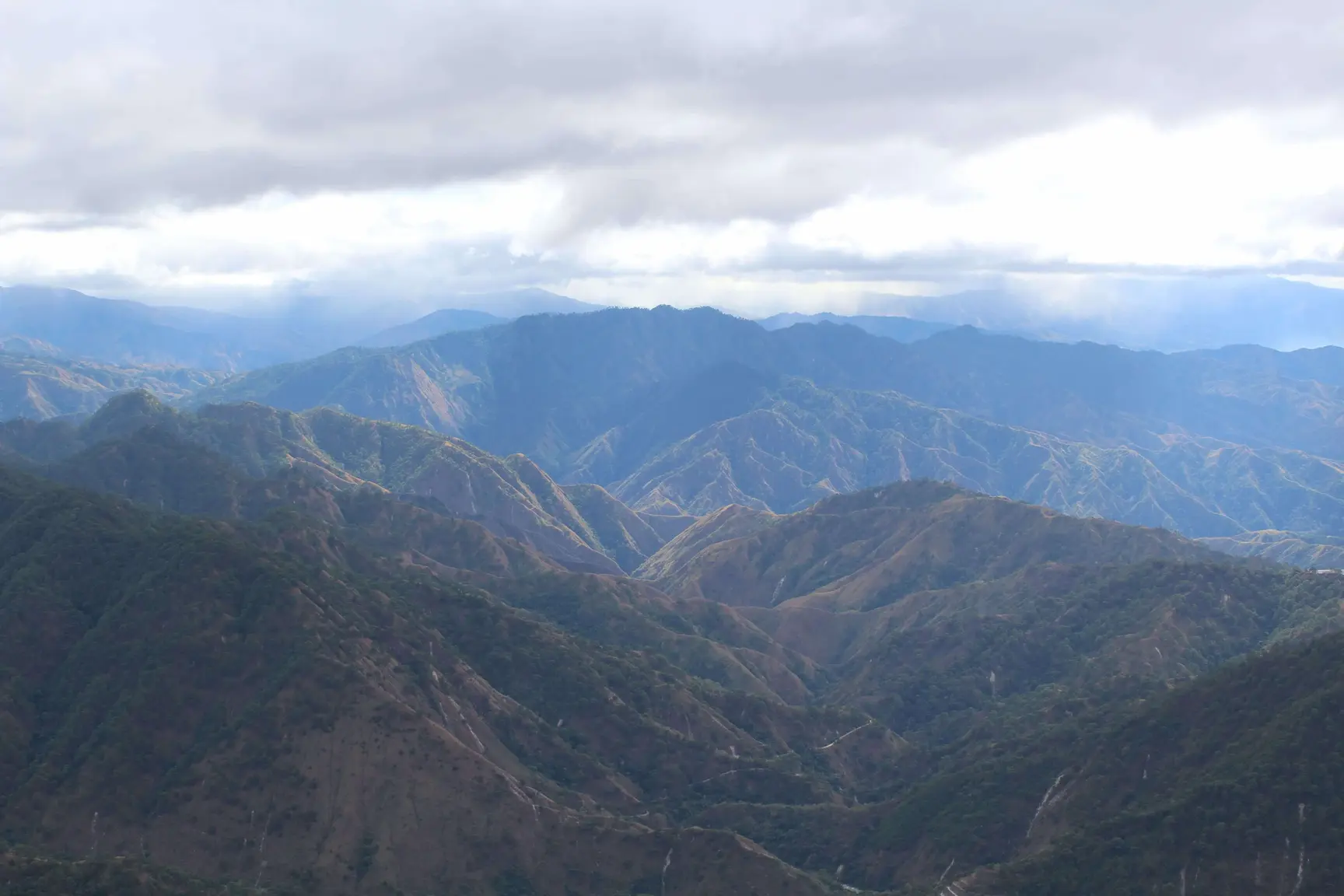
The mountain’s name, "Ulap," meaning "clouds" in the local dialect, perfectly captures the ethereal experience of hiking through misty peaks. With its cool climate and diverse flora, Mount Ulap offers a highly refreshing escape from the tropical heat of the Philippines. Rising to an elevation of approximately 1,846 meters above sea level, the mountain features diverse terrain—ranging from grassy slopes to rocky outcrops and serene pine forests.
Mount Ulap attracts many due to its easy accessibility, making it ideal for both novice and experienced hikers. Beyond its natural beauty, the mountain holds deep cultural significance. The trails pass straight through the ancestral lands of the indigenous Ibaloi people, adding a layer of historical depth to your journey.
Top Mount Ulap Trails: Exploring the Routes
The Ampucao-Sta. Fe Traverse
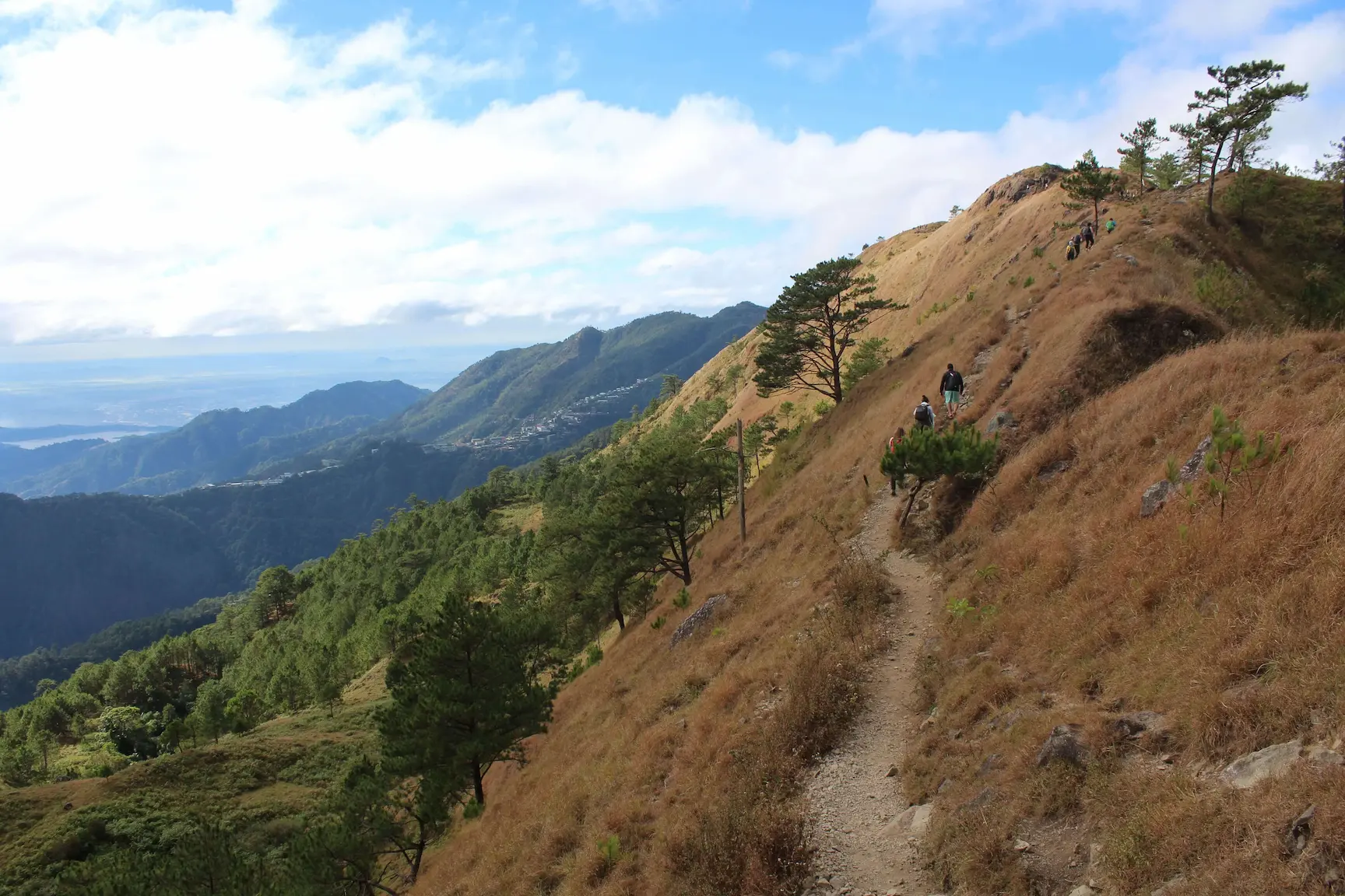
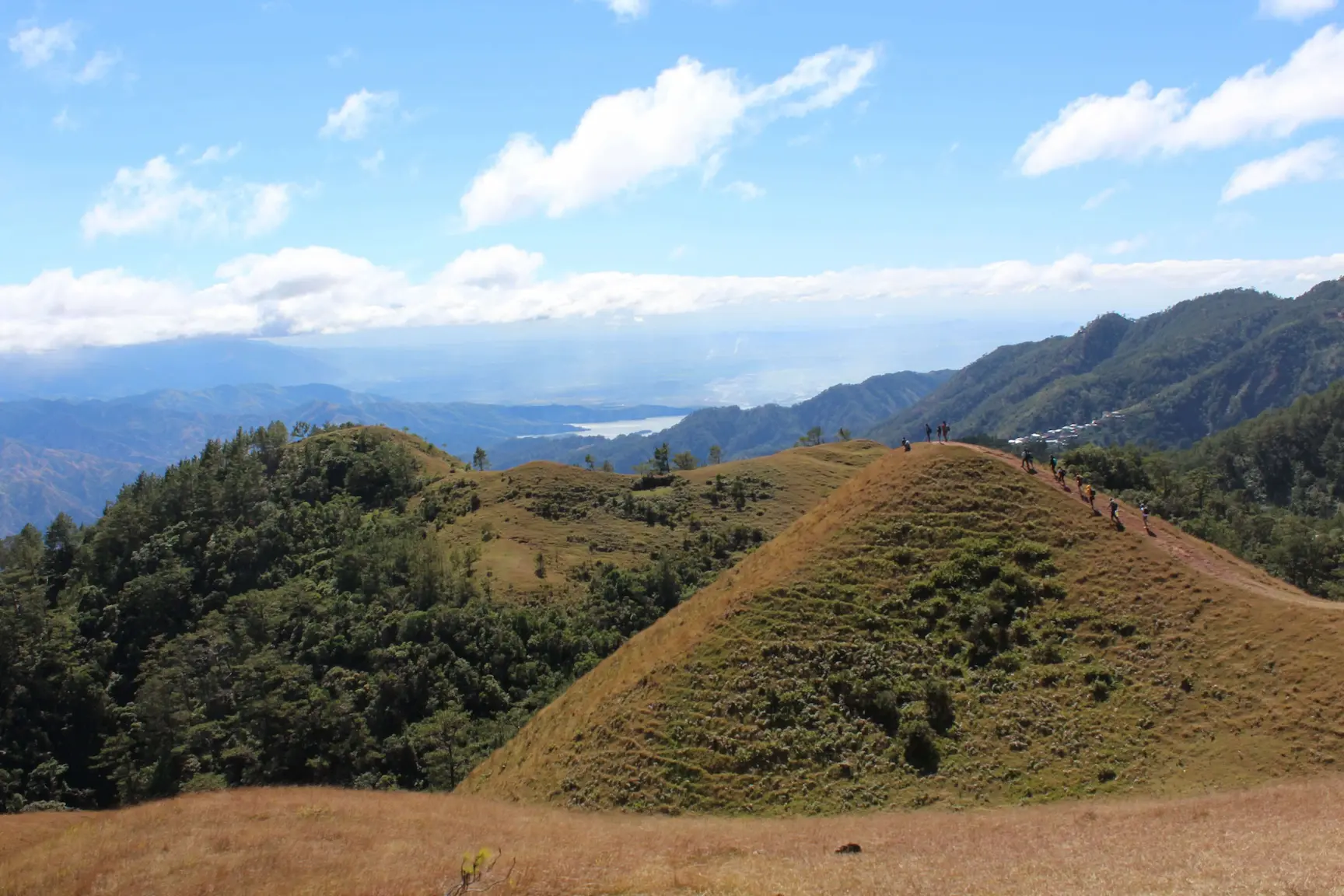
The Ampucao-Sta. Fe Traverse stands as the most iconic trail on Mount Ulap, stretching approximately 9 kilometers and offering a moderate challenge. Starting at the Ampucao jump-off point, this route takes you through rolling hills, grassy slopes, and pine forests, generating an elevation gain of about 600 meters. The trail’s open ridges allow you to enjoy unobstructed views of the Cordillera mountain range and, on exceptionally clear days, a distant glimpse of the Lingayen Gulf. Typically, the hike takes 4 to 6 hours to complete, ending smoothly in Sta. Fe. This traverse perfectly suits day hikers who want to experience the full beauty of the mountain without needing an overnight camp.
Gungal Rock Trail
For those seeking a shorter yet equally rewarding hike, the Gungal Rock Trail provides a fantastic option. This path branches off the main Ampucao-Sta. Fe route and leads straight to Gungal Rock, Mount Ulap’s most famous viewpoint. The trek takes about 1 to 2 hours from the trailhead, making it ideal for beginners or those pressed for time. Once you reach the summit, a breathtaking panorama greets you—rolling hills, pine-dotted slopes, and a mesmerizing sea of clouds drifting below. Gungal Rock ranks highly as a popular spot for sunrise hikes, so starting early (around 4 AM) ensures you catch the magical morning light.
Essential Hiking Tips for Mount Ulap
Embarking on a Mount Ulap hike requires proper preparation to ensure a safe and highly enjoyable experience.
Weather Preparedness
Mount Ulap’s weather shifts unpredictably due to its high elevation of 1,846 meters. Always check the forecast before your hike. Rain makes the trails slippery, and heavy fog frequently reduces visibility near Gungal Rock. Pack a lightweight raincoat, quick-dry clothing, and a sturdy hat. Start your hike early—ideally around 4 AM—to beat the midday heat and avoid afternoon showers, which hit the Cordillera region regularly.
Navigating the Terrain
The trails feature a tricky mix of grassy slopes, rocky sections, and pine forest paths. Good footwear with solid grip, like proper hiking boots or deep-tread trail shoes, proves essential. The Ampucao-Sta. Fe Traverse includes steep ascents and descents, so pace yourself carefully and use trekking poles for extra stability. Watch for loose rocks near Gungal Rock, and stay entirely on the marked paths to protect the landscape and avoid getting lost.
Capturing the Beauty: Best Photography Spots
Mount Ulap serves as a photographer’s dream, offering dramatic skies and unique vantage points.
Sunrise at the Peak
The peak provides the ultimate photography spot during sunrise. Start your hike early enough to capture the golden light illuminating the sea of clouds. Set up near Gungal Rock for the best angles. The interplay of soft morning light against the misty peaks creates a stunning, surreal effect. Bring a small tripod to stabilize your shots in the early dawn hours.
Pine Forest Panoramas
The pine forests along the trails offer another fantastic photography opportunity. Look for panorama points where the natural symmetry of the tall, slender pines contrasts beautifully with the rugged terrain. The cool, misty air adds a dreamy quality to your photos, especially after a light rain. Use wide-angle lenses to fully capture the vastness of the landscape.
Safety and Guidelines
The 9.4 km traverse from Ampucao to Sta. Fe holds a difficulty rating of 3/9, making it manageable for beginners, yet it still presents unique challenges. Start your hike early to avoid intense midday heat. The trail remains highly exposed in many sections, so apply strong sunscreen and bring a wind jacket. Temperatures often drop to 14°C at the summit between December and February.
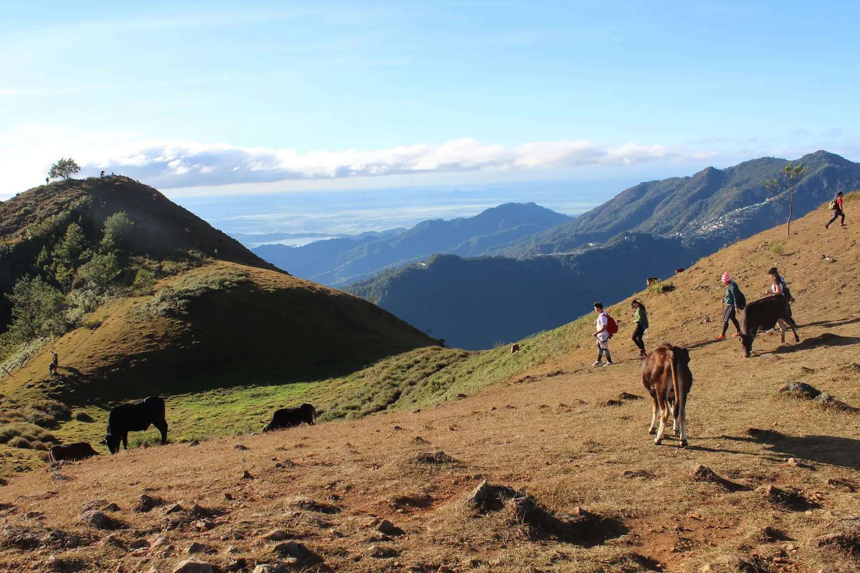
Hiring a local guide remains completely mandatory. Guides cost around 300 PHP per day and provide valuable insights while keeping you safe during sudden drops in visibility. You will encounter cows grazing along the trail; keep your distance and avoid provoking them for selfies to prevent accidents. Finally, strictly follow the "leave no trace" principle—bring your rubbish down and never pick the wild berries or rare flowers growing along the path.
What to Pack for Your Trek
The trail lacks water sources, so carry ample drinking water—aim for at least 2 liters per person. Pack high-energy snacks like trail mix, energy bars, and fruit to maintain your stamina. Bring a headlamp or flashlight with extra batteries if you plan to start early for the sunrise hike.
A basic first-aid kit containing bandages, pain relievers, and blister treatments will help you manage any minor issues. Do not forget a fully charged power bank to ensure your phone battery survives the hundreds of photos you will take.
How to Get to Mount Ulap
Located just 40 minutes from Baguio City’s Burnham Park, the jump-off point in Barangay Ampucao offers easy access for all travelers.
If traveling from Metro Manila, take a bus directly to Baguio City. Victory Liner offers excellent routes from Cubao or Pasay, with a travel time of 5 to 7 hours. Fares range from 800 to 1,000 PHP. Once in Baguio, head to the jeepney terminal near Centermall (just down Lakandula St.) to catch a public jeepney bound for Ampucao Barangay Hall. The ride costs around 50 PHP and takes about 45 minutes.
If driving, park at the Ampucao registration area, which accommodates roughly 10 vehicles. Keep in mind the Sta. Fe exit point differs from the start, so plan your return transportation carefully. Upon arriving at Ampucao Barangay Hall, register and secure your mandatory local guide. Registration opens at 5 AM for day hikes, with a strict cut-off at 12 PM.

Chat with your local guide to learn about hidden viewpoints positioned slightly off the main trail, often missed completely by rushing tourists. Bring small cash (in 50 PHP denominations) to tip your guide or buy snacks from locals selling fresh fruit near the Sta. Fe exit.
If you plan to hike in the dry season (February to May), make sure to arrive at the summit by 6 AM to catch the absolute clearest views before the thick clouds roll in.